Works offline · no signal · No ads
TriakaMap
TriakaMap
Created by riders, for riders

Navigation off-road
made by riders, for riders.

The serious tool for serious terrain. Device GPS that works without cell signal, downloadable offline maps, live groups, and active community. Created by riders, for riders — works where other maps give up.
AA
RP
JN
+
Created by riders, for riders
🚀 First launch · Join the community
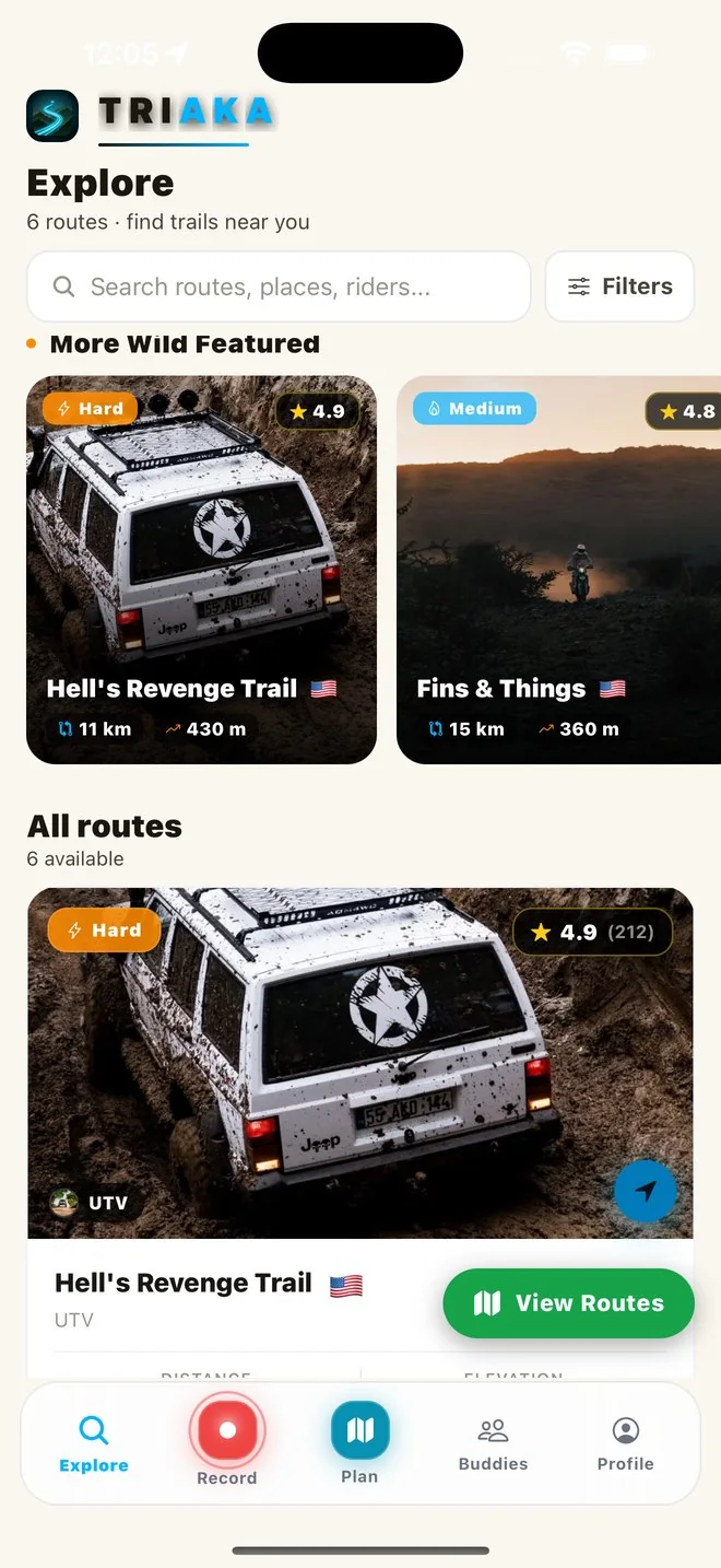
Pantalla Explorar rutas de Triaka
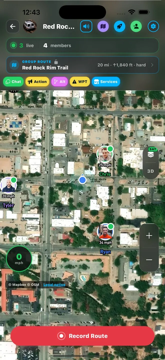
Pantalla de grupo en vivo de Triaka
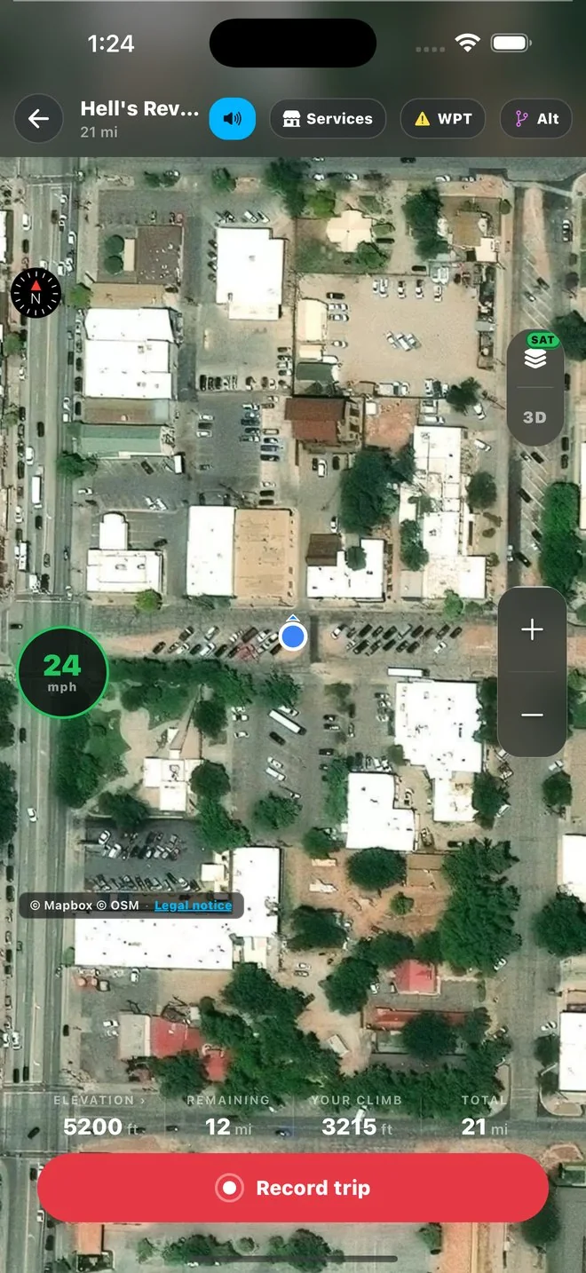
Pantalla de navegación GPS de Triaka
Explorar rutas
LIVE · OFF-ROAD COMMUNITY
Join the community of off-road riders
Trending this week

Featured routes

The highest rated by verified riders, sorted by activity from the last 7 days.
Wild
Hard

Mountain Loop

78 km +3.1k m 6h 40m
RP
Rider A
4×4 · 12 años
Score 92
Trending
Medium

North Ridge Trail

38 km +1.2k m 3h 20m
MC
Rider · MX
8 años en trails
Score 87
New
Easy

Coastal Loop

18 km +220 m 1h 15m
CJ
Rider · UTV
5 años off-road
Score 84
Rider 4x4 en trail
LM
Rider A
4×4 · expedición
38 km/h
Rider UTV
DF
Rider B
UTV · trail técnico
46 km/h
Rider motocross
RP
Rider C
MX · pista práctica
52 km/h
Mobile app

TriakaMap for iOS and Android

Take the tool to the mountains. Your map works offline once downloaded, and syncs as soon as the signal returns.

  • Device GPS — works without cell signal
  • Unlimited route recording · always free
  • Live tracking of your buddies
  • Ping the group with your last location
  • Real-time condition reports
System capabilities

All in one app.

Built specifically for serious terrain. Each feature addresses a real problem for the rider in the mountains.

Device GPS

Your position is calculated from the device's satellites — no cell signal needed. Sub-meter accuracy in remote areas.

Live Groups

See your buddies with speed and heading. Shared chat. Waypoints visible to everyone.

Ping your group

Tap once and your last GPS position reaches the whole group. Buddies see you on the map and get a push notification. Reference only — does not replace official emergency services.

Route Editor

Draw routes from your mobile or desktop with waypoints, hazards, and services. Instantly sync across all your devices.

Plan

Simple. Direct. No tricks.

Start free with all the essentials. Premium when you want more, cancel anytime.
Free
$0
/always
To get started. No card needed.
  • Live GPS tracking
  • Explore public routes
  • Route details & photos
  • Unlimited route recording
  • Chat with friends
  • Add friends (buddies)
  • Report trail conditions
Start for free
Start today

Your next
route starts here.

Download the app for free. No credit card. No commitments. Premium $4.99/month when you want more.